Geographical information
Territorial data management
A decision aid
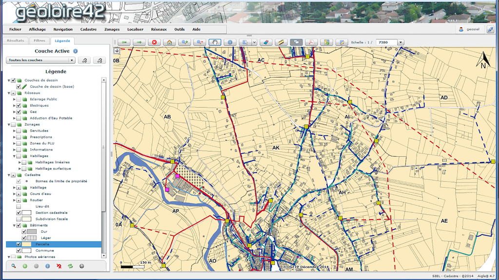
SIEL-Territoire d’énergie Loire has created a web-based Geographical Information System named Géoloire42. It is the result of a participatory approach that involved the local authorities that are members of SIEL-Territoire d’énergie Loire and several major players in territorial planning and development.
With Géoloire42, local authorities have a solution that allows them to use plans and maps, view data and to a wider extent, helps them to make decisions. On this web platform, local authorities can access the computerised land register maps, the land use plans (PLUs), their network plans (electricity, gas, street lighting, heating networks, etc.) as well as the data contained in the land register.
SUPPORT WITH PROVISING COMPUTERISED DATA
SIEL-Territoire d’énergie Loire also offers the municipalities technical, administrative and legal assistance, with the provision of computerised data and the setting up of mapping software: definition of needs, digitisation of maps, choice of providers, etc. Municipalities that already have a Geographic Information System can also call on SIEL-Territoire d’énergie Loire to update and maintain their systems.
The Géoloire42 solution constitutes a practical entry point for meeting planning regulation and works organisation requirements (DT/DICT declarations of works).